We planned to hike the White Mountain Peak trail on Saturday and climb the Mountaineer's Route on Mt Whitney on Sunday. But a severe thunder storm on late Saturday afternoon and unfavorable weather forecasting on Sunday stopped us from attempting the Whitney summit.
1. Grandview campground
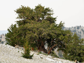
The four of us left the Bar Area about 8am on Friday, and arrived at the Grandview campground around 4pm. Concerned about the weather condition (T-storm was forecasted mid-day), we decided to have an early start at 3am. After pitching out tents, we left for the trailhead to prepared ourselves for driving in the dark. It took an hour to drive the 20 miles approaching road, 16 miles of which were dirt road. This road is drivable for a passenger car, but I would not drive anything other than a 4WD giving its distance. There were two group of people camped at the trailhead. We had talked about camping there, but decided not to do so due that some people might have difficulty in sleeping at 12,000 feet without acclimation. On the way back, we took some short hikes to see the ancient bristlecone pine trees and to acclimate ourselves to the elevation. It was unbelievable that the world's most ancient trees are found in a high altitude desert. But this is probably due to i. the place is not easily accessible to human beings, and ii. the terrain is too barren to allow the trees to grow big enough for timber wood.
We went back to the campground around 7pm. After some quick dinner, we crept into our sleeping bags at 9 to get ready for a 2am wake-up. But I soon found that sleep was a luxury in this campground. It was by far the most noisy night I had even spent in any campgrounds. The noises were not from mother nature, but from other campers. The Grandview campground is very popular among amateur astronomers and star-gazers who usually don't sleep, and I did find the sky clear and beautiful despite the smoke from nearby forest fires. There were a group of people (I didn't know if they were star-gazers) keeping shout out until 1am as if they were the only group in a full campground. This gave me one hour's sleep before the hike.
Other than the unfortunate human noise, this is a very nice campground. A 3 dollars' donation is requested.
2. White Mountain Peak

Waking up at 2am, we left camp promptly and had our feet on the trail by 3:20. The temperature is mild, about 40 degree near the trailhead at 12,000 ft elevation. I carried 3 liters of water since there was not any water source along the 7.5 miles' trail. The "trail" was indeed a dirt road leading to the UCSD research facility and to the observational station at the summit. You could not miss it even in a moonless night. The first 2 miles before the UCSD research facility was rather flat. We got there in about 35 minutes.
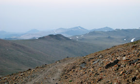
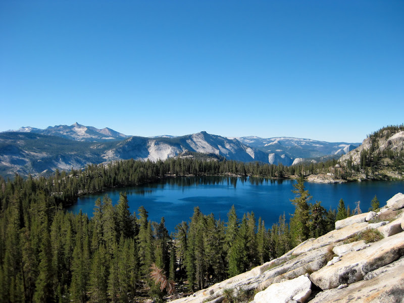
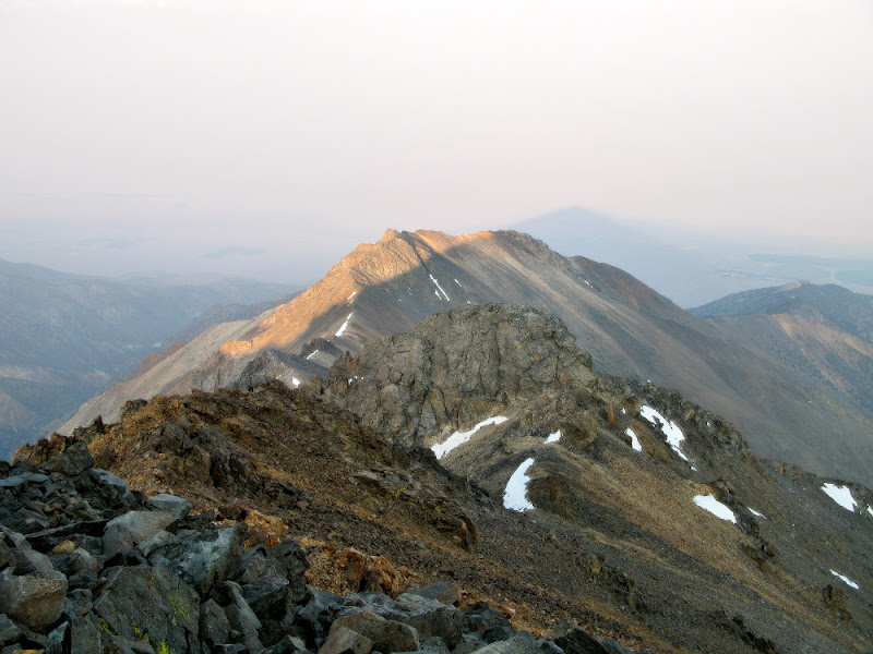
Passing the main building, I smelled the "legendary" goats, but I could only see their eyes reflecting light from my headlamp. The next and last landmark before the summit hut was an old observatory a half mile further. There was a gentle climbing during the half mile which took us about 15 minutes. From the observatory, I could see the outline of the White Mountain Peak in the dark sky. With the acclimating hikes yesterday and "one night's" sleep at 8,500 feet, all four of us did pretty well so far and we kept our pace until our first snack break at 5:00. We stopped at what appeared to be the top of a hill at 13,100 feet, and we had hiked 5 miles at this time. The morning twilight came in, bringing along a great view of the southeast face of the White Mountain Peak. We could also see the barren yet colorful land which had long been described as extra-terrestrial.
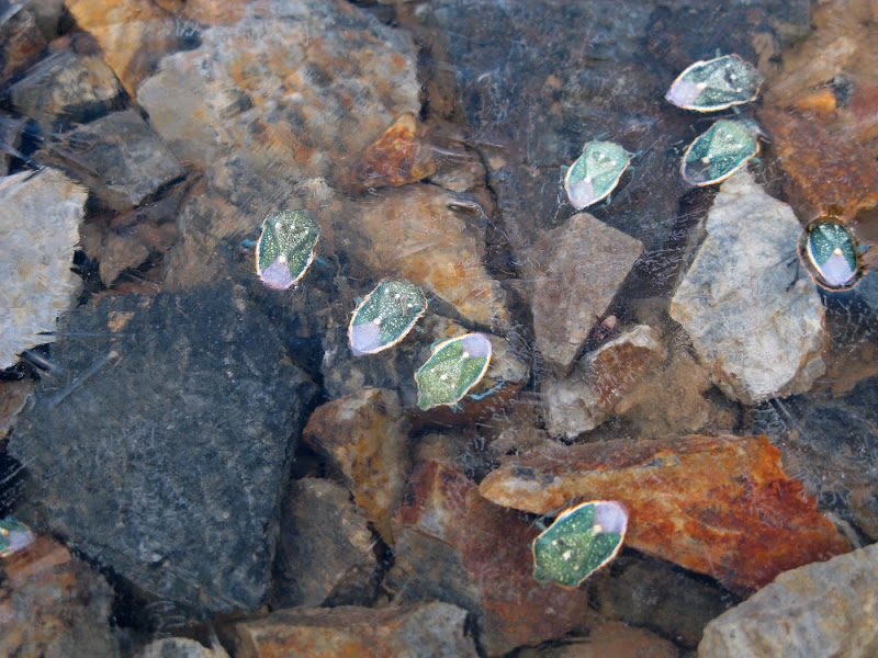
After a 15 minutes' break and refueling, we started a brief down-climbing of a couple hundred feet, and then the final ascending to the peak. This last two and a half miles were relatively steep with many switchbacks. The sun showed itself in the mist/smoke around 5:40 and the land were painted with a reddish color. The last section of the trail was still partly covered in snow. At one point when I passed the edge of a snow field, I saw some green-colored bugs frozen under a ice layer. I didn't know if they were already dead, or they would move again after the sun melt the ice.

Crossing an snow field of about 100 feet long, I finally reached the summit at 6:30. My GPS recorded the one-way distance of the trail to be 7.5 miles.
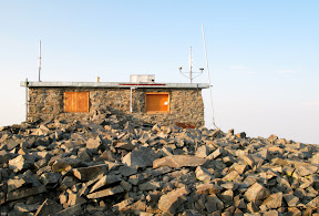
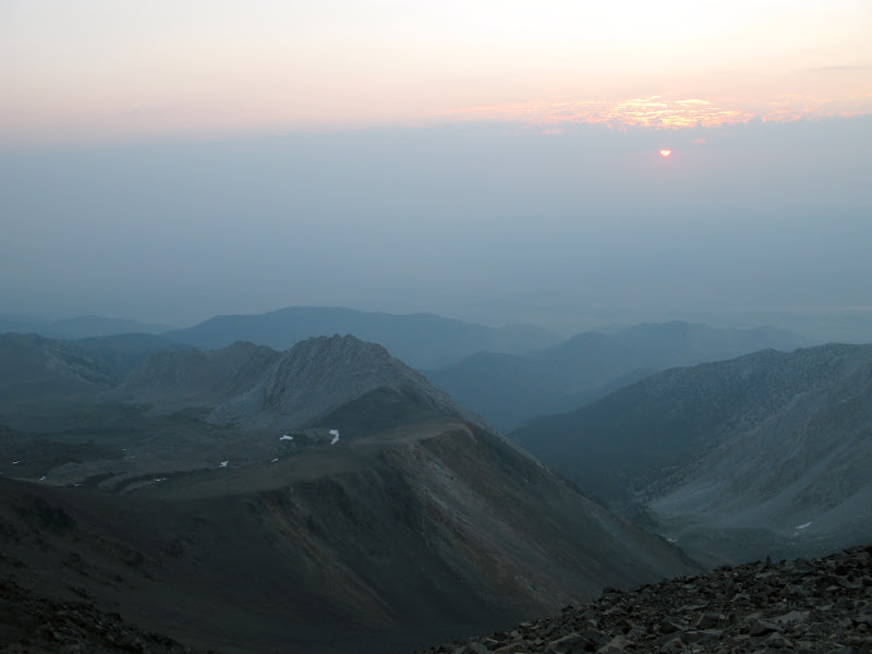
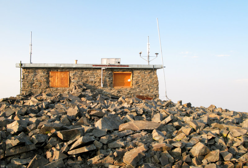
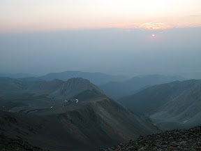
The summit of the White Mountain Peak is composed of a research hut built on top of a huge pile of stones. We tried to located the USGS summit seal but failed. It was chilly at 14,265 feet in the early morning although the sun had already started to shine. The view on the summit, contrary to popular description, was not very impressive, presumably due to the smoke and mist which blocked view of the High Sierra.


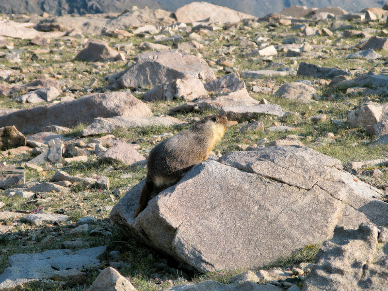
We started our descending at 7:00. I cut through a few switchbacks to avoid the snow crossing and to visit the owners of the land -- marmots. At the foot of the summit peak, we met the second group of hikers of the day. They had camped at the trailhead and started shortly after us. There were not many hikers on that day, probably due to the bad weather forecast. We met about 10 others before we got to the trailhead at 9:50.
Back to the campground, we broke camp after a short rest. The fifth member of the team appeared shortly after noon, and we left for the Forest Service Long Pine Ranger Station to get our Mt Whitney permits.
3. Whitney Portal
We arrived at the Ranger Station in Long Pine a few minutes before 2pm. A ranger told us that there would be 64 no-show permits available after 2. I had expected that we should be able to get permits, but the high no-show rate (they assign 100 day-hike permits for the whole Whitney zone each day) still surprised me, probably due to the bad weather. After getting our permits and personal mountain bags (a.k.a. pooh bags), we left for Whitney Portal. We had a
campsite reservation at the Long Pine campground, but we wanted to try our luck at the Whitney Portal walk-ins which would save our a half hour's sleeping time.
This place is a real "portal", with high vertical cliffs at three sides and one small opening to the east. The parking lots were almost full, but the hiker's one-day camp is pretty empty. They charge 8 dollars per tent, well, they actually charge by site, but each site is just big enough for a single tent. We pitched up our tents, and I cooked some simple dinner at 5pm to get ready for an early sleep.
I was not able to finish my last pieces of noodles before I heard the first thunder, with rain drops following in seconds. I dumped whatever was in my pot quickly and move all stuff into the tent. Water began to pour down right after I zip off the tent flyer. The downpour continued until 7pm. It was still raining, but I was able to get out of the tent and clean the mess I left on the picnic table.
I wake up at 2am to prepare for leaving. Water was still dripping off the trees. I was a little concerned about the trail condition before Bill, our trip leader, told me that the rain didn't stop until midnight. The storm had caused a major mudslide which closed the road to Long Pine. The Mountaineer's Route is along the North Fork Creek, which could be in terrible shape after the storm, if still passable. We decide to call off the attempt and delay new planning to after
sunrise.
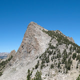
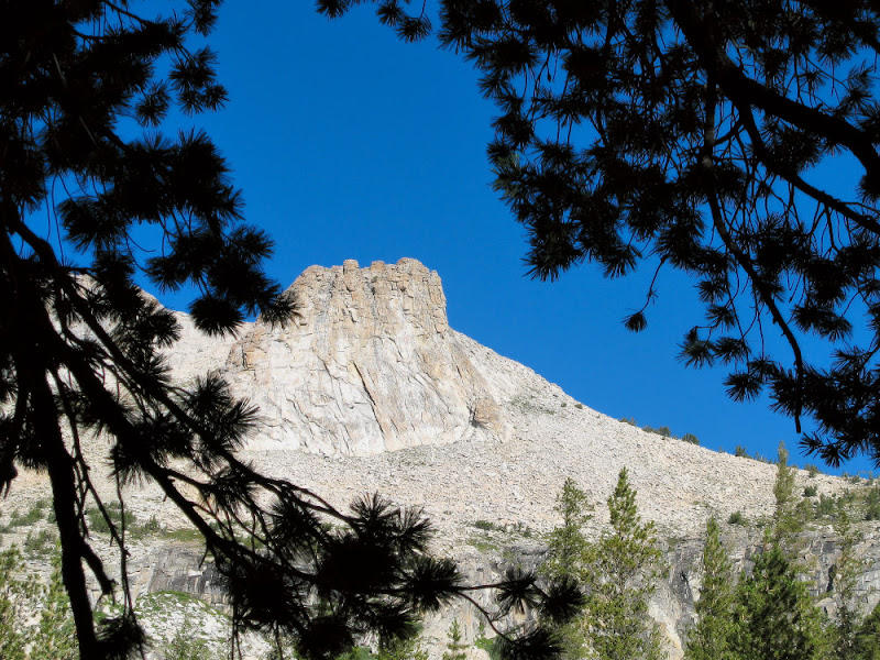
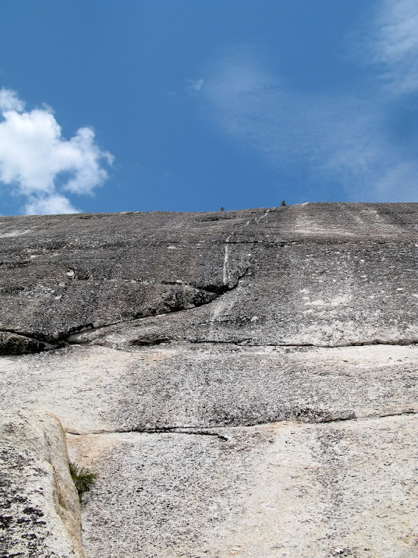
4. Lembert Dome
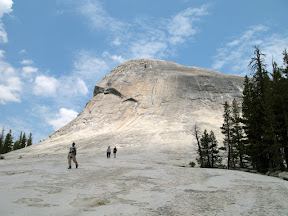
The new plan was to drive northern enough to avoid the damage from the storm, and do some third class scrambling. The Lembert Dome at Tuolumne was the hill of choice. We had passed the peak on our way here. I was surprised when Bill told us that the southeast route to the top of the dome was class 3. It looked really steep. But our eyes could be easily cheated by perception.
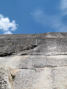
Stopped by a mudslide in the valley along 395 for an hour, which gave us the chance to recognize the High Sierra peaks, we arrived at the Lembert Dome around noon. We took the third class southeast route up and had a sunny summit. As we start descending, we could see that storms were forming on top of the southern peaks. We attempted the 4th class route for the down-climbing and everyone had done great.
After having a juicy buffalo burger at the Iron Door of Groverland, we returned to the Bay Area around 7pm to end the weekend adventure.